

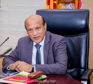
Mr.Tissa Kumarasiri Warnasuriya
Hon. Governor of the North Western Province
For the first time in the history of Sri Lanka, which is sailing towards a digital era in a cutting-edge technological world that uses artificial intelligence, an infrastructure system with full information can be scanned from the headquarters in a moment, even in every home unit of all local government bodies in the province using GIS technology. This website will set a great example not only for all provincial councils but also for all government institutions. It is a great honor to initiate this step for the first time by our North West Provincial Council. By providing consultancy to the entire country, this institution has risen to the heights of success and fruit, while at the same time, it is an example of working to use only the available financial, physical and human resources with maximum effectiveness at the lowest cost. I would like to express my gratitude in advance.
Services


Mrs. Sanjeewani Herath
Commissioner of Local Government - North Western Province
As the current North West Local Government Commissioner, I see this project or the Sri Lanka Digitization Foundation as an information technology library. All local governments should use this. This contains information required for local government administration. I am happy to inform you that the advice and guidance necessary for the success of this as well as the government support will be given continuously and further.
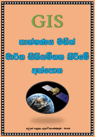
M.M.S. PREMACHANDRA
Operating Cordinator
This GIS project was launched in the middle of 2017 in the North West Province with the basic objective of mapping the developed areas of the local government councils belonging to the North West Province. At the beginning Started with 17 departmental officers and we have now been able to create a dedicated training team that can cover the entire North West Province. By using this team, we were able to map the roads of all the local governments, Plateau, prepare the road nomenclature, mapped a large number of street lights, bridges and culverts, collect information and prepare a data system in the North-West province .
We pay our respects to the North West Provincial Chief Secretary and the Local Government Commissioners who have given approval, advice and guidance to our journey so far. Taking this as a precedent, it is my aim to make a digital Sri Lanka with mapping.


About Us
SRI LANKA DIGITALIZATION BASE is a Service name that clearly conveys the purpose of the government, which is to provide mapping and data collection services in Sri Lanka. The name combines the name of the country with the term 'DIGITALIZATION,' indicating that the government specializes in providing geographic information about Sri Lanka. The use of the country name in the Service name also suggests that the
By 2025, all roads that belong to Local Government entities will be fully mapped and the Gazette notification will be published following road mapping,
The Minister of State emphasizes that this scheme will be implemented after 36 years, through which it will be possible to identify the roads belonging to the respective local authorities.
SRI LANKA DIGITALIZATION BASE is a innovation project that newly Initiated in Sri Lanka, and you're looking for information, we would recommend checking official web sites, press releases, or news articles related to the this unit.
Learn More
Based on GIS our innovation projects in Sri Lanka
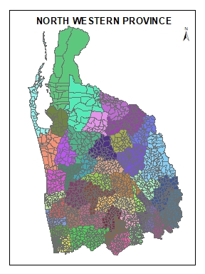
Making the North West Province into small units based on the local government, all the data in those units will be aggregated according to the models of the operational office and created under several layers of geographic maps. For this purpose, using the geographical information technology units established in each local government and the trained and experienced officers working in those units.
- Infrastructure
- Population distribution
- Land consumption
- Business information
- Historical and cultural information
- Natural resource information
- Water and irrigation information
- Administrative information
- Disaster Management Information
- Climate change
A geographic information technology unit has been started for the 33 local government agencies under the North West Local Government Department with the aim of carrying out the functions mentioned in the basic law of those agencies. Under that unit, more than 50 officials of local government institutions were given geographic information technology training, and nearly 800 officials were given geographic data collection training. Through mapping and publishing 161 developed areas related to local government using those officers and mapping the road network in the North West Province, 46423 roads owned by local government , 585 roads belonging to Provincial Road Development Department, Road Development Authority A total of 48000 roads have been mapped as 165 owned roads, 130 roads owned by the Irrigation Department, 173 agricultural roads, 187 roads owned by Mahaweli Authority and 331 private roads. From this, all the roads owned by the local government have been declared for the first and second time and the road rights of 18745.12 kilometers have been confirmed. Through this, the North West Province was able to save an amount of 9048 million rupees.
The abilities of the officers who worked full-time in the above activities for a few years have grown to a very high level and based on the continuous training provided to accomplish those activities, they have been able to generate an amount of human resources that cannot be measured in money. Currently, 50 officers are being given formal training at Kelaniya University.
The ability to use the above group of officials as a great resource not only for the North-West Province but for the entire island is well established. Already, those officers are contributing resources to support the above activities in the two provinces of Sambaragamuwa Province and North Central Province.
This group of officers is working in the 33 North-West local governments and geographical IT units have been created in those local governments and are carrying out the IT work of those institutions.
Through the proper management of this valuable human resource and the provision of necessary resources, it is possible to create a complete information system that includes all the data in the North-West Province at a very low cost and thereby make the public service of the North-West Province efficient and provide a more effective public service to the people.
Infrastructure
All facilities and maintenance details such as road system, street lights, culverts etc. are stored and maintained in timely updates and are used in necessary situations. This project, which is proposed to be implemented as such, can be identified as a needs. It is possible to monitor and view the information of the development projects carried out by at any time. This will provide an opportunity to easily identify the scarcity of resources, waste and fraud in the country.
Population distribution
Through this project is proposed to create all the building information in the domain from the Gs officer domain level and the information of each house and the details of their residents will be created. Accordingly, all building information and population distribution as well as family details are prepared as a network
Land consumption
The houses, fields, land use for various activities, mountains, forests, empty land and their ownership are represented. This provides the opportunity to study the distribution of land in the developed area information quickly. There will also be an opportunity to get all the information.For example, the amount of land and paddy land owned by one person can be easily and quickly provided. This information is extremely important for the regulation of agricultural activities, as well as the ability to identify uncultivated land and study how to remedy it.
Business information
The business location survey is a primary source of income for The local governments and in relation to that, manufacturing and business establishments should be classified according to their capacity. The information obtained in this way can be developed as a tool to streamline revenue collection in local government as well as identify market opportunities such as agriculture, self-employment.
Historical and cultural information
Can be provide the Information about the location, history and significance of temples, shrines, other shrines, archaeological sites, cultural villages and sites in the relevent area.
Natural resource information
The presence of forest water source, mineral resources, their use, identification of destruction conditions according to the time period, as well as the need to reconstruct suitable environmental conditions can be identified.
Water and irrigation information
This will provide an opportunity to get information easily and accurately for all the canals, lakes, dams, waterfalls, information development activities in the area. It will be possible to achieve development goals through information about the country's irrigation system, which is mainly based on agriculture.
Administrative information
Through this system information is collected about the government , semi-government institutions, capacity and resources in the government institutions, other public places in the province and the jurisdictions where the tasks that can be performed are implemented.
Disaster Management Information
Nowadays, it is observed that many human lives and property are damaged due to natural calamities. These disasters occur many times in the North-West Province. Accordingly, The areas that are flooded, landslides are identified according to the rainfall values and other natural conditions. By identifying the disaster situation in advance and providing information, it is possible to support the protection of human lives as well as property, and maintain high risk areas as well as areas where construction of houses is not allowed.
Climate change
Through this, it is possible to identify the fertile areas for each type of crops such as rainfall, wind, flood. Based on the time frame can be connected the information required for agriculture and agribusinesses to the above layer disaster according to conditions and Soil conditions
Clients
Projects
Hours Of Support
Hard Workers

Our Vision
Navigating a digital future
Our Mission
To create, improve and maintain a comprehensive and up-to-date data system with real-life maps including all data of public administration, natural resources, infrastructure, land consumption, population, etc. located in the geographical area of the North-West Province and the data required by administrative decision-makers. Providing effective public service in the province by assisting in making public administration efficient by providing analysis.
Our Clients


Services
It is our duty to keep the information of all our above mentioned projects updated. Accordingly, it is essential to provide the necessary information to use the information network created by the system for all administrative purposes.
Testimonials
It is a privilege for the public to step into a Sri Lanka Mapping Innovation Program. A dedicated group has emerged in the North-West Province. It is our expectation that the service to the general public will be effective through their dedication.
I consider myself privileged to be involved in a mapping project like this while working in the IT field in the public service for over 18 years. This is a stepping into the new world. Very happy to work here.

H.N.Weerasena
Web Site Design & Coding
Sri Lanka Digitization Foundation in 2019. Founded by Mr. Premachandra. It should be mentioned that I gave my approval, advice and guidance as the North West Local Government Commissioner at that time to implement this concept of his. This program, which was started in North West, is now spreading all over Sri Lanka. It is my wish that the whole of Sri Lanka will function as the only digitization base through this.

Mr.I.M.I.Ilangakoon
Secretary of Governor - North Western Province
A sustainable future can be created after modern global technological achievements, including ‘AI’ technologies, are applied to common goals. “The Management Center for Geographic Information Systems”, built and operated by the Northwestern Provincial Council, has developed the necessary information technological background to better the planning process and sustainably fulfil the public expectations of the Northwestern Provincial Council of Sri Lanka. Through this management centre, the efficiency, effectiveness, and reliability of the provincial public service will be further strengthened. It is also a privilege to have an opportunity to contribute to this information technological revolution in the history of Sri Lanka's local government to the Department of Geography at the University of Kelaniya. And this will undoubtedly set an excellent example for other provincial councils in Sri Lanka. I am thankful to all forerunners who are dedicated to making public expectations become a reality. The public service here will create a better future for the people of the Northwestern Province through this information technological revolution.

Prof. Nishan Sakalasooriya
University of Kelaniya
I am proud to have been able to start the process of geographic mapping first in the North West Province. It is my duty to provide efficient public service to the people through such technical programs as appropriate to the needs of the era. I believe that the information and data required by the public administration can be obtained very easily through this. Through this, it will be possible to assemble information belonging to all sectors including health, education and local government, and make administrative decisions based on that information. I am informed that the necessary instructions and guidance will be given soon to implement this geographical mapping process throughout Sri Lanka, which was started in the North West Province.

Mr. Ranjith Ariyaratne
Past Chief Secretary - North Western Province
Joining a group which is interested in digitization, being able to support that group using modern knowledge and being able to support the technical consultation of the Digital Foundation National Program, which is a startup from the North Western Province in the field of geographical information technology, is an achievement in my career. The technical unit of our team aims to provide a more efficient service to the public service and the public through information technology and technologies such as Geospatial AI, AR, and ML, while opening the way towards the technical applications with modern artificial intelligence.
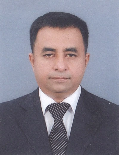
W.M.T.R.Wanninayaka
ICT Consultant - Wayamba GIS Project
Our Projects
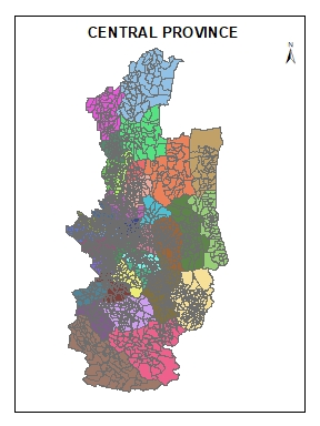
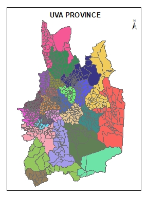
Below are some of the mapping programs carried out by our team so far. A large group of trained people in the province has supported this..
- All
- CP
- WP
- UP
- EP
- NWP
- NP
- SP
- NP
- NCP
- SGP




Our Team
Pilots in providing effective service to the people using new technology to increase the efficiency of public service

W.R.T.M Gunathilakas
GIS Trainer and map Developer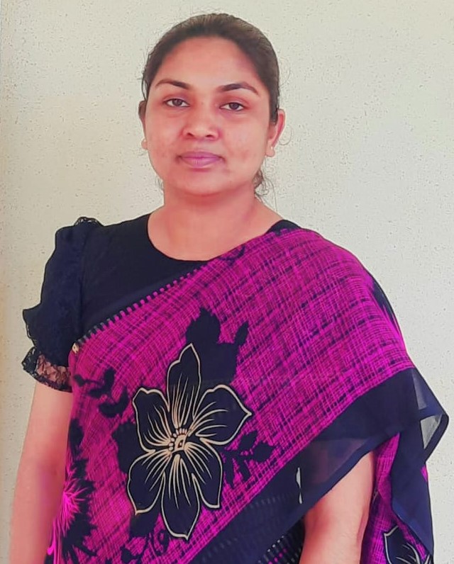
S.L.P. Thanuja
GIS Trainer and map Developer
E.M.S.K. Ekanayaka
GIS Trainer and map Developer
D.M.S.J.Dissanayaka
Software DeveloperContact
Lanka mapping innovation' unit is established in Ministry of Agriculture North West Provincial.
Location:
Ministry of Agriculture - North western Province
Email:
sldb.nwpgis@gmail.com
Call:
Operating Cordinator:
+94718056114
+94762444174
E.M.S.K. Ekanayaka:
+94718987930